
There are over 260 amazing miles of maintained hiking trails in Mount Rainier National Park! Visitors can find anything from easy hikes to the PCT (Pacific Crest Trail spanning over 2,600 miles) and everything in-between. With this much diversity, I will try to focus on the best Mt Rainier Hikes that most park visitors will hike in a day trip to this amazing National Park!
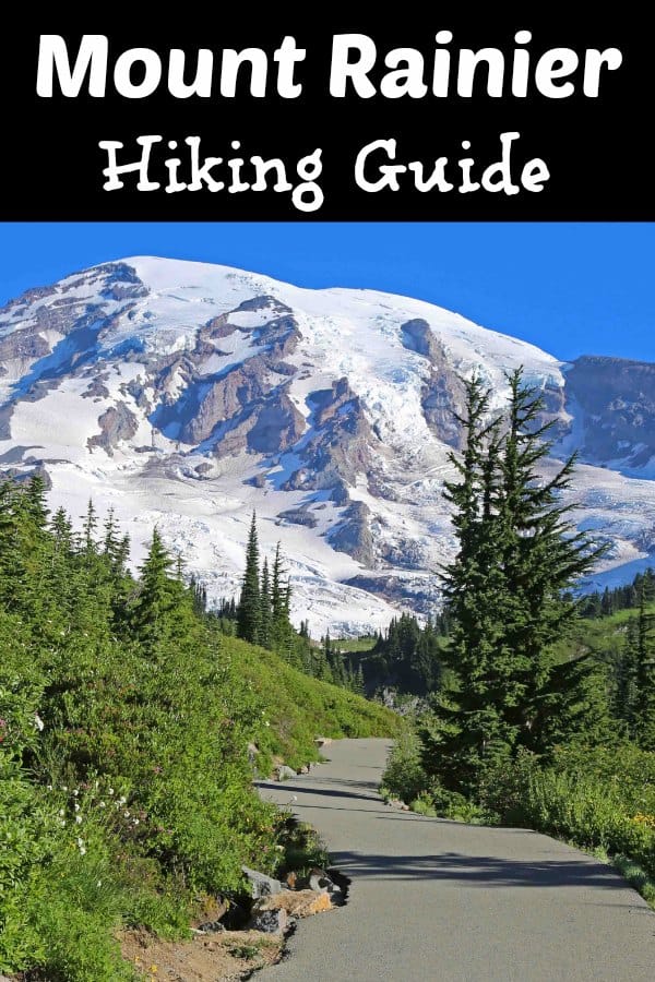
Best Mt Rainier Hikes
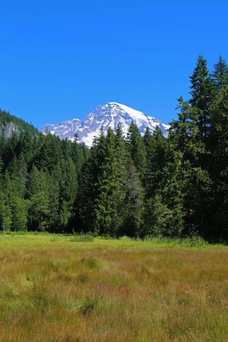
Cloudy days may obscure views of the mountain but don't let that stop you from visiting. The park offers incredible views of lakes, wildflowers, wildlife, and waterfalls, all of which can be seen even when the mountain is covered in fog.
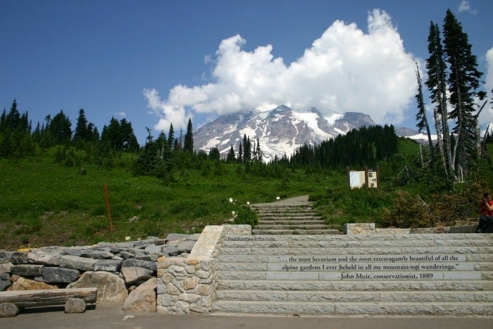
Mt Rainier also has several pull-outs and short interpretative hikes that offers scenic views that rival that of Switzerland. July and August are the best times to see Mt Rainier wildflowers.
Longmire Area Trails
Trail of the Shadows
- Trail Length: 0.7-mile loop trail
- Elevation Gain/Loss: slight
- Hiking Time: 20 minutes
- Trailhead location: Across the street from the National Park Inn
Trail of the Shadows is one of the shortest park trails and is just across the road from the National Park Inn at Longmire. Walk to a cabin, possibly a replica, of that built by early homesteaders. It is a self-guided trail. The loop winds around a beautiful meadow with informative stations about James Longmire and his dreams for a natural health spa. I personally loved the view of the mountain from the meadow.
Twin Firs Loop Trail
- Trail Length: 0.4-mile loop trail
- Elevation Gain/Loss: slight
- Hiking Time: 20 minutes
- Trailhead Location: 2 miles west of Longmire.
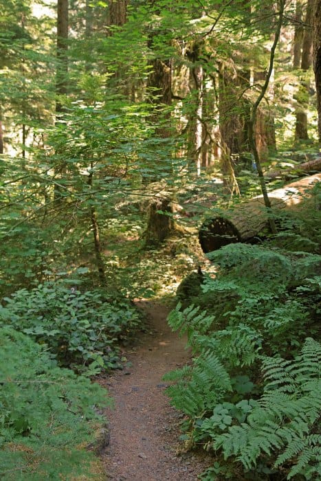
One of the shorter park trails, this is great for children and beginners. It passes through an old-growth forest of Douglas Fir, Western Hemlock, and Western Red Cedar, and crosses several streams. Look for skunk cabbage, nurse logs, and giant ferns. There is an exhibit that describes the plants of the low-elevation forests.
Rampart Ridge Trail
- Trail Length: 5.1-mile loop trail
- Elevation Gain/Loss: 1275'
- Hiking Time: 2-3 Hours
- Trailhead Location: Across the street from the National Park Inn in the Longmire Historic District.
This is a great trail to hike in June as Paradise area trails are still typically covered in snow. It is also a trail that will give you a little distance and elevation gain to get the heart pumping.
Park Ranger John Pro Tip:
Make sure to hike the loop in a clockwise motion to maximize your chances to have epic views of Mt Rainier!
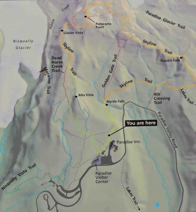
Paradise Area Hikes
I always recommend that park visitors take a look at the Paradise Inn WebCam before hiking in the Paradise Area to help them best prepare for their trip. You may ask why? Did you know that Paradise at Mt Rainier held the world record for the most measured snowfall in one snow season at 1,144 inches!
That's a staggering 95.3 feet of snow, the same height as the world's fastest, steepest, and tallest spinning coaster, Time Traveler at Silver Dollar City in Branson Missouri.
In the winter, check ahead to make sure the roads to Paradise are open. Vehicles are required to carry tire chains from November 1 to May 1.
Alta Vista Summit Trail
- Trail Length: 1.6-mile paved loop
- Elevation Gain/Loss: 560
- Hiking Time: 1 Hour
- Trailhead Location: Paradise Inn Parking Lot
The Alta Vista Summit Trail is known for incredible wildflower viewing in the summer (July-August) and dramatic panoramic views of Mount Rainier and the surrounding foothills all year long.
This is a great hike for children and beginners, with sweeping views of subalpine meadows' wildflowers, sweet little creeks, and stunning views of the Tatoosh Range and Mount Rainier.
Some parts have steep climbs, and it is at a high elevation, but people can go as far as they want then turn around. Take it slow and stop at the open space with resting logs. Look for marmots (like groundhogs that whistle).
Nisqually Vista Trail
- Trail Length: 1.2-mile paved loop trail
- Elevation Gain/Loss: 200 feet
- Hiking Time: 45 minutes to 1 hour
- Trailhead Location: west of Jackson Visitor Center
See Fairy Pond, if early in the season. One of the super easy hikes, Nisqually Vista Trail goes through forests and meadows and has beautiful views of the Nisqually Glacier (on Mt. Rainier). Take this as a self-guided trail or as a guided tour with a ranger in summer.
Skyline Trail
- Trail Length: 5.5-mile loop
- Elevation Gain/Loss: 1,700 feet
- Hiking Time: 3-4 hours
- Trailhead Location: Paradise Parking Lot.
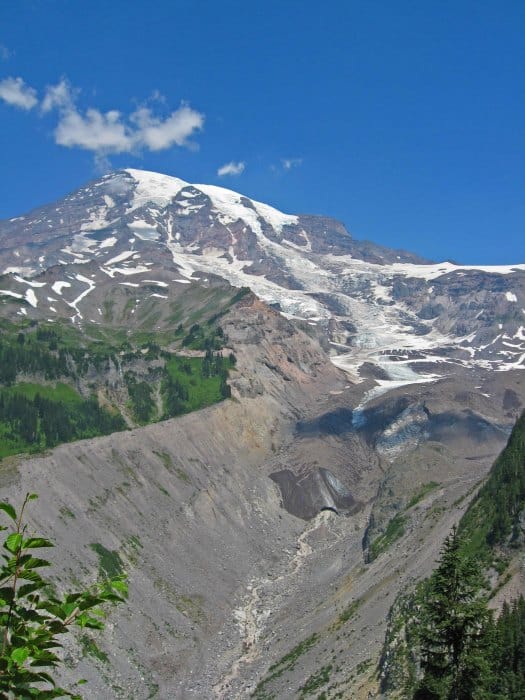
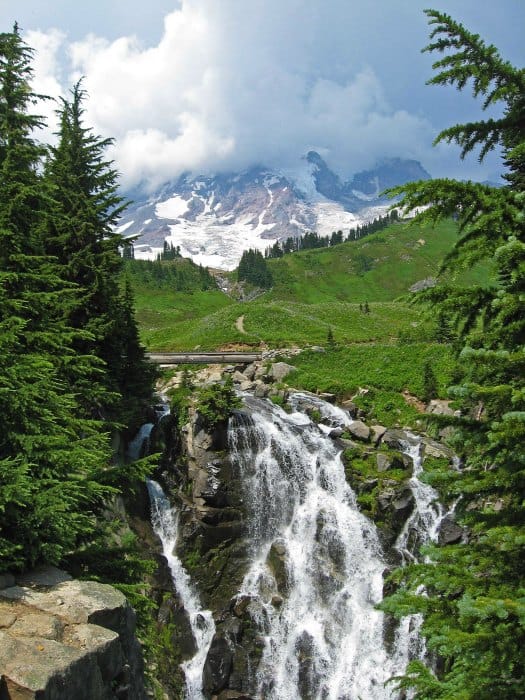
The Skyline Trail is one of my favorite all-time hikes in the National Park system! This summertime hike gives you incredible fields of wildflowers, an epic view of Myrtle Falls with Mt Rainier as a backdrop, and Paradise Glacier.
Panorama Point is a great lunch spot with a breathtaking view of t St. Helen's, Mt Adams, and Mt. Hood!
Ohanapecosh Area
Hot Springs Nature Trail
- Trail Length: .5 mile out and back
- Elevation Gain/Loss: 50 feet
- Hiking Time: 30 minutes
- Trailhead Location: Behind the Ohanapecosh Visitor Center
Hikers get to experience this lush green forest with massive Douglas Firs and Hemlocks to the bubbling water Ohanapeosch Hot Springs.
Silver Falls Trail
- Trail Length: 3 Miles
- Elevation Gain/Loss: 350 feet
- Hiking Time: 2 Hours
- Trailhead Location: Starts at loop B of the Ohanapeosch Campground and ends at the Ohanapeosch Visitor Center
This is the most stunning of the easy hikes for many Washington State locals. Use extreme caution and supervise small children. Stay on the trail because rocks are wet and slippery.
The Ohanapecosh River falls 75 feet as it flows between the rocks and produces a silver spray. The trail follows the Ohanapecosh River, through old-growth forests and is recommended as an easy hike for beginners and small children.
Walk the trail as a loop by crossing the river on the bridge near the falls.
Grove of the Patriarchs Trail
- Trail Length: 1.3-mile loop trail
- Elevation Gain/Loss: 50 feet
- Hiking Time: 1 hour
- Trailhead Location: First trailhead on the right after passing the Stevens Canyon Entrance traveling westbound.
*UPDATE* The Grove of the Patriarchs Trail received major damage from flooding in late 2021. The Trail is closed until further notice and is planned to be closed for all of 2022 and 2023.
Along the road, just west of the Stevens Canyon Entrance Station, the Ohanapecosh River surrounds an island with thousand-year-old Douglas firs and western red cedars. Walk the trail to feel the peace, and find a space that is, possibly, better than the Redwoods in California.
Sunrise Area Trails
Sunrise Nature Trail
- Trail Length: 1.5 Miles
- Elevation Gain/Loss: 300 feet
- Hiking Time: 45 minutes
- Trailhead Location: Upper end of the picnic area
This self -guided loop trail has incredible views of Mount Rainier and the Cascades.
Shadow Lake Trail
- Trail Length: 3 miles
- Elevation Gain/Loss: 270 Feet
- Hiking Time: 1.5 hours
- Trailhead Location: Sunrise Parking Area
This easy trail descends to beautiful Shadow Lake and is one of the mid-level park trails. There are great views of White River Valley and Mount Rainier, along with wildflowers in the subalpine meadows.
Sourdough Ridge Trail
- Trail Length: 1.3-mile loop
- Elevation Gain/Loss: Minimal
- Hiking Time: 1 hour
- Trailhead Location: Sunrise parking lot
1 mile, north side of Sunrise parking lot, 1 hour, loop trail
Sourdough Ridge Trail is one of the easy hikes for families and small children, with a gentle climb to the top of the ridge. It has self-guided markers along the way, explaining the ecosystem. There are fantastic views of Mt Rainier, Mt Baker, Glacier Peak, and Mt. Adams.
If that's not enough to entice you, the wildflowers definitely will! You can expect to see numerous wildflower types in the summer including paintbrush, subalpine daisy, aster, and much more.
Large Trails at Mt Rainier
Wonderland Trail
- Trail Length: 93 miles
- Elevation Gain/Loss: Lots! (Yes this is the official comment from the NPS as well)
- Hiking Time: Usually done over several trips as permitting is difficult to obtain
- Trailhead Location: several.
The Wonderland Trail is the epic Mount Rainier National Park Trail. This trail covers 93 miles including the lowland forest to the sub-alpine areas of the park.
If you plan on tackling this incredible trail I would suggest really preparing early for this epic adventure.
PCT (Pacific Crest Trail)
- Trail Length: 2653 Miles
- Elevation Gain/Loss: Too much to count!
- Hiking Time: Several Months
- Trailhead Location: The Pacific Crest Trail can be accessed at Chinook Pass where it crosses SR 410 via a log bridge, or from the Tipsoo Lake Loop Trail.
Only a small portion of this multi-state trail crosses into Mount Rainier along its Eastern border. Hands down, the best part is where the PCT crosses over Chinook Pass over Highway 410, also known as the Mather Memorial Parkway.
The Parks Log entrance sign serves as two purposes; A park entrance sign and two, a trail bridge over the Chinook Pass Highway. I was so surprised the first time I come driving through the bridge as saw people hiking on the sign!
Mount Rainier National Park Entrance Fee
Park entrance fees are separate from camping and lodging fees.
Park Entrance Pass - $30.00 Per private vehicle (valid for 1-7 days from the date of purchase)
Park Entrance Pass - Motorcycle - $25.00 Per motorcycle (valid for 1-7 days from the date of purchase)
Per-Person Entrance Pass - $15.00 Visitors 16 years or older who enter on foot, bicycle, or as part of an organized group not involved in a commercial tour.
Annual Park Entrance Pass - $55.00, Admits pass holder and all passengers in a non-commercial vehicle. Valid for one year from the month of purchase.
$30.00 for Commercial Sedan with 1-6 seats and non-commercial groups (16+ persons)
$75.00 for Commercial Van with 7-15 seats
$100.00 for Commercial Mini-Bus with 16-25 seats
$200.00 for Commercial Motor Coach with 26+ seats
Learn more about National Park Passes for parks that have an entrance fee.
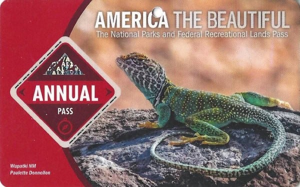
$80.00 - For the America the Beautiful/National Park Pass. The pass covers entrance fees to all US National Park Sites and over 2,000 Federal Recreation Fee Sites for an entire year and covers everyone in the car for per-vehicle sites and up to 4 adults for per-person sites.
Buy your pass at this link, and REI will donate 10% of pass proceeds to the National Forest Foundation, National Park Foundation, and the U.S. Endowment for Forestry & Communities.
National Park Free Entrance Days -Mark your calendars with the free entrance days the National Park Service offers for US citizens and residents.
Additional Resources
Mount Rainier Camping Guide - Complete guide to all of the campgrounds within the park.
Top things to do Mount Rainier National Park - All the things you don't want to miss while in the park.
National Parks in Washington - Check out all of the parks you can visit in Washington
Most Visited National Park Sites - Find out if Mount Rainier made it on the most visited national parks list.
National Park Bucket List - How many bucket list national park adventures have you taken?
Paradise Mt. Rainier Guide - Check out all of the amazing things to see and do while visiting Paradise.
Kid Friendly Hikes in Washington - Great hiking trips that are perfect for the entire family.
Make sure to follow Park Ranger John on Facebook, Instagram, Pinterest, and TikTok


Leave a Reply