
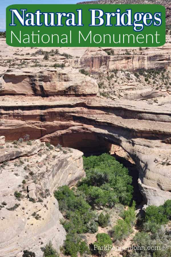
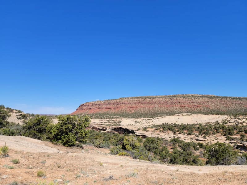
Natural Bridges National Monument in Utah is home to three natural bridges that were created by ancient rivers. The park was the world's first international dark sky park.
TL;DR Don't have time to read the full article? Here are my top finds:
🏨Hotels and Vacation Rentals
📍Tours
🐻 Save time! Buy your National Park Pass before your trip
Natural Bridges National Monument
Natural Bridges was Utah's first National Monument. The park protects three natural bridges that were created by rivers
About Natural Bridges National Monument
It features the thirteenth largest natural bridge in the world, carved from the white Permian sandstone of the Cedar Mesa Formation that gives White Canyon its name.
The bridges are named "Kachina," "Owachomo" and "Sipapu" in honor of the ancestral Puebloans who once made this place their home
Is Natural Bridges National Monument worth visiting?
Yes! The park offers visitors the chance to explore three natural bridges without the big crowds from some of the nearby National Parks.
History of Natural Bridges National Monument
The incredible state of Utah is ripe with national parks and monuments. Utah has immense geological and biological diversity. Among the disparate wonders of the state, Natural Bridges was Utah's first national monument.
The Forming of the Natural Bridges
The namesake of the park is its three sandstone natural bridges. These impossible formations were millions of years in the making.
Western Interior Seaway
More than 60 million years ago during the late-Cretaceous Period, a massive sea covered most of the interior of what is now the United States. From Alaska to the Gulf of Mexico and from the Rockies to the Appalachians, the Western Interior Seaway allowed marine life to thrive for millions of years.
Water depths varied considerably through the Western Interior Seaway's history. When the seaway was at its most shallow, rainfall led sediment to the seafloor.
Occasionally exposed islands within the seaway allowed grasses, trees, and other plants to grow and die. This long history of life and death of plants and marine life created layer upon layer of sediment on the ocean floor.
Through time and pressure, many geologic layers or strata were created. The layers varied in density depending on its organic and mineral constitution. When the Western Interior Seaway was eventually displaced by geologic uplift, massive deposits of sandstone, limestone, and shale were left behind.
Erosion's Slow Work
The exposed sandstone, limestone, and shale were subjected to the erosional forces of mother nature without the protection of the seaway. Rivers replaced the seaway.
Flowing water slowly wore away at the exposed rock. Flowing water will always follow the path of least resistance.
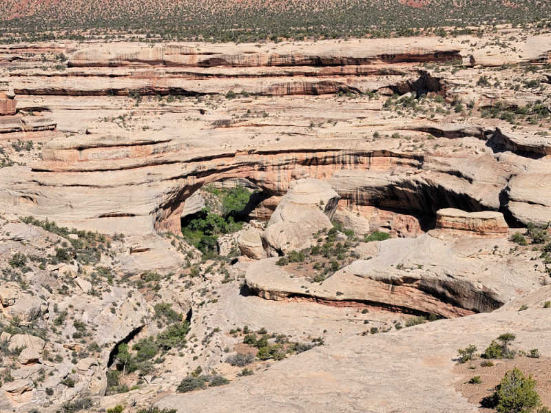
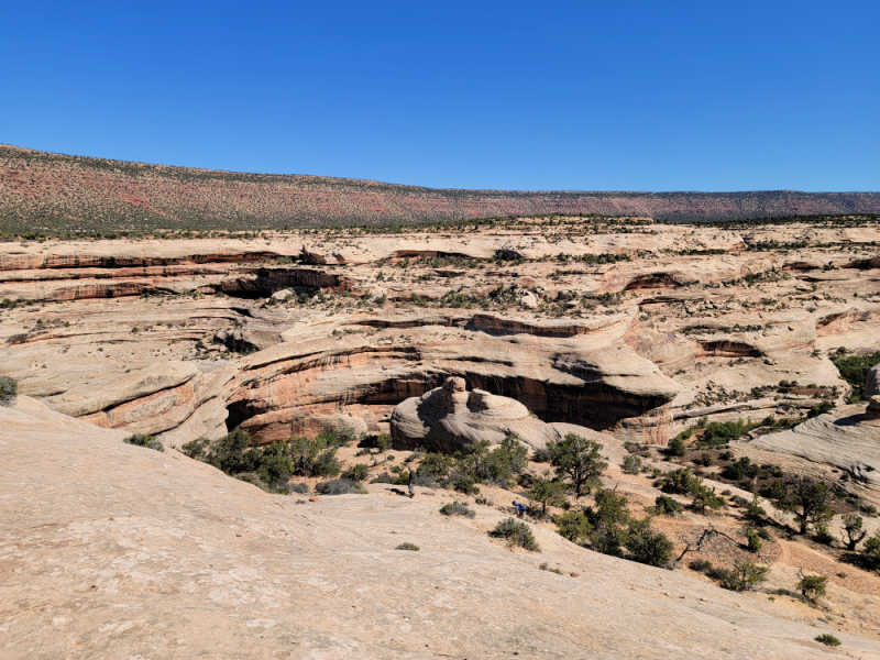
Paths carved by rivers formed the winding and looping canyons evident in aerial photography of Natural Bridges National Monument.
The three fascinating bridges in the park were formed by the continual flow of rivers coupled with the onrush formed by those same rivers during flash floods.
Year after year as flash floods slammed into the looping walls of the canyons, the canyon walls thinned ever so slowly.
Eventually, the river made its way through the softer sections of canyon walls creating entirely new river routes running under canyon walls.
Each year the swollen river's course would undercut the canyon walls, widening and raising the bridge.
The Three Bridges of Natural Bridges National Monument
The three remaining stone bridges at Natural Bridges National Monument are all accessible by hiking trails. Their unique names come from the Hopi language and are Sipapu Bridge, Kachina Bridge, and Owachomo Bridge.
These names were not applied until the early 1900s, replacing earlier titles given by White explorers in the late 1800s and early 1900s. The government's choice to give these lands Hopi names reflects the long residency of the area by Native Americans
Owachomo Bridge
Owachomo is thought to be the oldest and seemingly frailest of the bridges. The bridge spans nearly 200 feet across the valley floor and is nearly 100 feet off the ground.
It is the most easily accessible of the bridges. There are several paths that will allow you to view the bridge either from the topside or below the structure.
The bridge was named Owachomo in the 1900s after the area came under protection by the federal government. Owachomo means "rock mound" in Hopi.
Prior to federal protection and renaming, explorers, miners, and proprietors of the bridge called it "Congressman" and "Edwin."
Sipapu Bridge
In reference to age, Sipapu Bridge falls in the middle. Its Hopi name grandly means "the opening between the worlds." Prior to the 1908 renaming, it was known as "President" and "Augusta."
Sipapu has the widest span of any bridge within the park and is the sixth-longest natural bridge in the world at 255 feet. Paths lead from the rim to the base of Sipapu where it is possible to view its enormity up close.
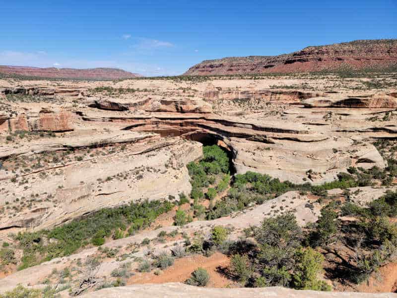
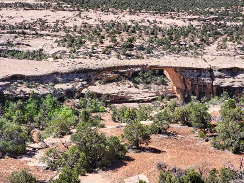
Kachina Bridge
The youngest and thickest of the natural bridges is Kachina. The bridge is famously adorned with dancing petroglyphs - symbols carved into the rockface of the bridge.
Kachina is thought to mean "ghost dancer" in honor of the petroglyphs. Its prior names include "Caroline" and "Senator."
The Kachina Bridge stands over 200 feet off the canyon floor and spans 204 feet. Like Sipapu and Owachomo, it is possible to hike beneath its grand span.
Ancestral Puebloans, Paiute, and Navajo
The U.S. legally took possession of the canyons comprising Natural Bridges National Monument following the Mexican-American War (1846-1848).
Long before U.S. explorers and cartographers encountered the bridges, several prehistoric groups lived among canyons and on the mesa tops.
Earliest Settlers
Petroglyphs are found throughout the park such as those at the base of Kachina Bridge. Archaeologists have dated these glyphs and discovered artifacts to as early as 7,000 BCE.
The arrival of Ancestral Puebloans
During the 500s CE Ancestral Puebloans began to spread across the region. Ancestral Puebloans created dugout homes for their first few centuries on the plateau but famously began constructing Great Houses and pueblos around 1000 CE.
For more than 200 years Ancestral Puebloans lived, farmed, and built complex structures from sandstone. At Natural Bridges National Monument you can visit buildings nearly 1,000 years old at Horse Collar Ruin. They are tucked in a canyon alcove nearly 30 feet off the canyon floor.
The Puebloans dispersed from the area in the late 1200s leaving impressive structures throughout the area. The impetus for moving was likely changing climate which made mesa-top farming less successful. There was also increasing pressure and competition from other tribes arriving in the area.
Navajo and Paiute Arrival
The Navajo are thought to have arrived in the U.S. Southwest as early as 200 CE from what is modern-day Canada.
Scholars think the Paiutes arrived later around 1000 CE at the same time Puebloans began their new construction techniques.
As more Navajo people adapted to the social and environmental conditions of their new locale, Navajo culture began to dominate.
Navajo culture eventually supplanted Puebloan culture and controlled southern Utah until the arrival of Spanish conquistadors reshaped trade and culture in the area during the 16th century.
Natural Bridges National Monument is home to three incredible wonders including one of the longest natural bridges in the world. Uncrowded hikes can connect you with topside and canyon-floor views. Stunning Puebloan ruins are waiting for you.
Things to know before your visit to Natural Bridges National Monument
Natural Bridges National Monument Entrance Fee
Park entrance fees are separate from camping and lodging fees.
Park Entrance Pass - $20.00 Per private vehicle (valid for 1-7 days from the date of purchase)
Park Entrance Pass - Motorcycle - $15.00 Per motorcycle (valid for 1-7 days from the date of purchase)
Per-Person Entrance Pass - $10.00 Visitors 16 years or older who enter on foot, bicycle, or as part of an organized group not involved in a commercial tour.
Annual Park Entrance Pass - $55.00, Admits pass holder and all passengers in a non-commercial vehicle. Valid for one year from the month of purchase.
$20.00 for Commercial Vehicle with 15 or less seats
$40.00 for Commercial Vehicle with 16-25 seats
$100.00 for Commercial Motor Coach with 26+ seats
Learn more about National Park Passes for parks that have an entrance fee.
$80.00 - For the America the Beautiful/National Park Pass. The pass covers entrance fees to all US National Park Sites and over 2,000 Federal Recreation Fee Sites for an entire year and covers everyone in the car for per-vehicle sites and up to 4 adults for per-person sites.
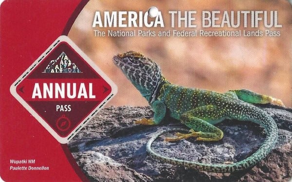
Buy your pass at this link, and REI will donate 10% of pass proceeds to the National Forest Foundation, National Park Foundation, and the U.S. Endowment for Forestry & Communities.
National Park Free Entrance Days -Mark your calendars with the free entrance days the National Park Service offers for US citizens and residents.
Time Zone
Mountain Time Zone
Pets
Pets are allowed on all park roads and parking areas, in the campground, on paved paths to bridge viewpoints, at paved pullouts along the scenic drive, and in picnic areas.
Pets are not allowed on any hiking trails, off trails, or in the visitor center.
Cell Service
There is no cell service available in the park.
Park Hours
The monument is open 24 hours a day, year-round.
The Natural Bridges Visitor Center is typically open daily, 9 am to 4 pm. In winter, the visitor center is closed Tuesdays and Wednesdays and on certain holidays.
Wi-Fi
There is no Wi-Fi available at the park
Insect Repellent
Insect repellent is always a great idea when outdoors, especially if you are around any body of water.
We use Permethrin Spray on our clothes before our park trips.
Water Bottle
Make sure to bring your own water bottle and plenty of water with you. Plastic water bottles are not sold in the park.
Parking
There is a nice parking lot by the visitor center. Each overlook has a parking area.
Food/Restaurants
There are no restaurants within the park. We suggest packing snacks and drinks with you.
Gas
There is no gas within the park. The closest towns for gas are Blanding and Monticello, Utah or Cortez, Colorado.
Drones
Drones are not permitted within National Park Sites.
National Park Passport Stamps
National Park Passport stamps can be found in the visitor center.
Make sure to bring your National Park Passport Book with you or we like to pack these circle stickers so we don't have to bring our entire book with us.
Natural Bridges NM is part of the 1998 Passport Stamp Set.
Electric Vehicle Charging
The closest EV Charging Station are in Bluff, Monticello, and Blanding, Utah
Details about Natural Bridges National Monument
Size - 7,636 acres
Check out how the park compares to other National Parks by Size.
Date Established - April 16, 1908, by President Theodore Roosevelt
National Park Address
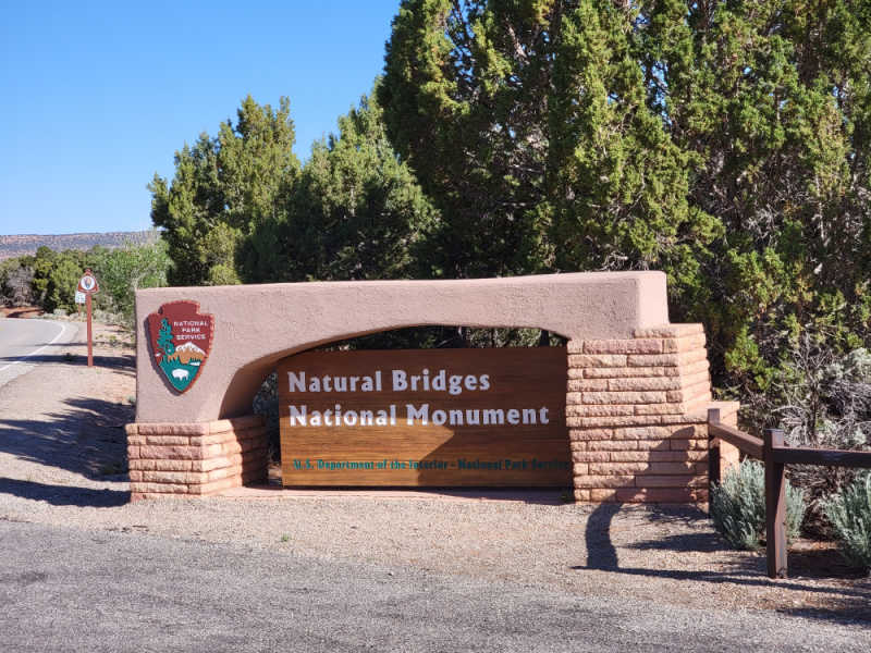
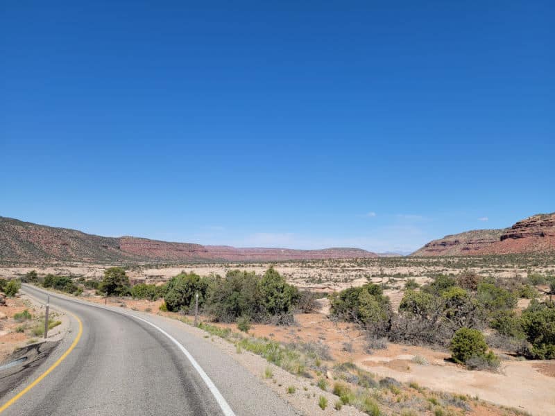
The entrance to Natural Bridges is at the end of UT 275, which is roughly 35 miles west of Blanding, Utah, on UT 95.
The driving time from Blanding is roughly 45 minutes.
Natural Bridges National Monument Map
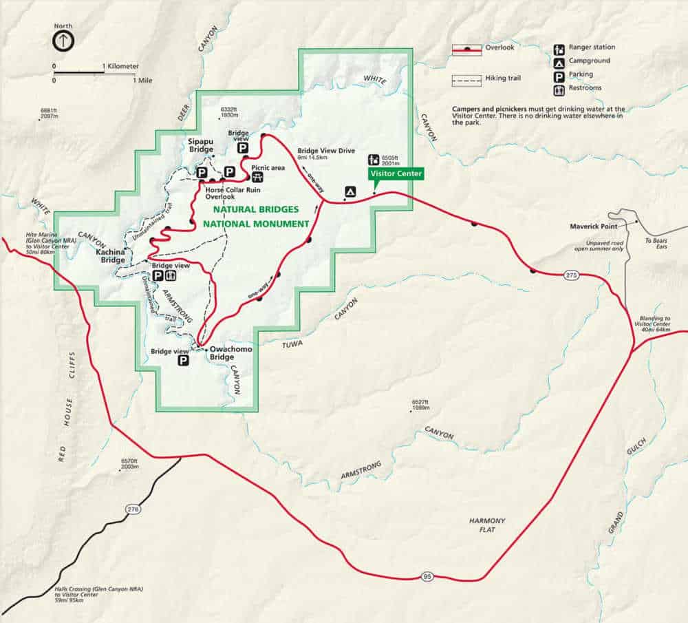
Where is Natural Bridges National Monument?
Natural Bridges NM is located in south eastern Utah near the border with Colorado.
Estimated distance from major cities nearby
Albuquerque, NM - 343 miles
Colorado Springs, CO - 477 miles
Denver, CO - 501 miles
Aurora, CO - 507 miles
Scottsdale, AZ - 391 miles
Henderson, NV - 477 miles
Phoenix, AZ - 382 miles
Las Vegas, NV - 460 miles
Estimated Distance from nearby National Park
Canyonlands National Park - 148 miles
Arches National Park - 121 miles
Mesa Verde National Park - 132 miles
Black Canyon of the Gunnison National Park - 235 miles
Petrified Forest National Park - 253 miles
Grand Canyon National Park - 218 miles
Where is the National Park Visitor Center?
The visitor center is located off the main road leading into the park.
Getting to Natural Bridges National Monument
Closest Airports
Cortez Municipal Airport (CEZ)
International Airports
Albuquerque International Sunport (ABQ)
Regional Airports
Canyonlands Field (CNY)
Four Corners Regional Airport (FMN)
Durango - La Plata County Airport (DRO)
Driving Directions
The driving time from Blanding is roughly 45 minutes.
- From Blanding, Utah, drive just south of town on US 191 to UT 95.
- Take UT 95 about 35 miles west to UT 275.
- The entrance to Natural Bridges is at the end of UT 275.
Bus Services
There is no bus service to the National Monument.
Best time to visit Natural Bridges National Monument
The best time to visit is late spring through fall. The weather should be comfortable during this time.
Weather and Seasons
The park is part of the Colorado Plateau which is a "high desert' region.
Blanding, Utah experiences hot dry summers while winters are short, freezing, and snowy.
The hottest weather is from May 29 to September 14th with an average daily high of 79 degrees Fahrenheit.
The coldest weather is from November 22 to February 19th with an average daily low below 47 degrees Fahrenheit.
The most snow falls between November 13th to March 12 with the most snow in January.
One thing to remember is the late summer is monsoon season which brings afternoon thunderstorms which can create flash floods.
Best Things to do in Natural Bridges National Monument
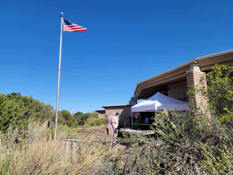
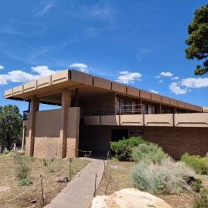
Visitor Center
The visitor center is open from 9 am to 5 pm.
The building is closed on Thanksgiving Day, December 25, and January 1.
Exhibits, a video presentation, restrooms, and a park bookstore are available.
There is a 10-minute film available upon request at the visitor center.
We did not get the opportunity to go inside the visitor center since they had a table set up outside. The park store has a ton of books and souvenirs.
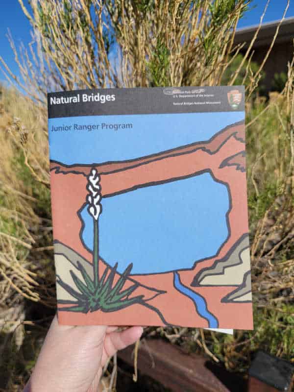
Junior Ranger Program
The Junior Ranger Program is a fantastic way to learn more about the park for all ages. We have done over 150 Junior Ranger Programs and love working on them while in the park.
You can print the Junior Ranger Booklet [1 MB PDF file] before your trip to start learning about the park.
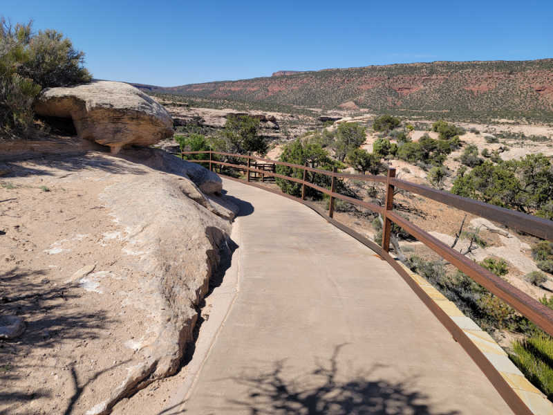
Bridge View Drive
Plan at least an hour or two for exploring the scenic drive. If you plan to hike to the natural arches you will want to plan a bit more time.
Each overlook and trailhead has limited parking; if you are towing a trailer, unhook it and leave it in the visitor center parking lot.
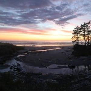
Dark Sky Park
On March 6th, 2007, Natural Bridges National Monument became the first International Dark Sky Park certified by the International Dark-Sky Association.
Natural Bridges has made protecting its night sky a priority so that people can enjoy the stunning river of light formed by the Milky Way rising over Owachomo Bridge.
You can camp in the park making it easy to enjoy one of the darkest skies.
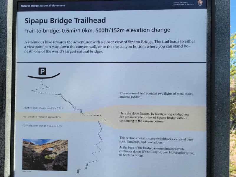
Sipapu Bridge
With a span of 268 feet, Sipapu Bridge is the largest natural bridge in the park and the second largest in the United States.
- Height: 220 feet (67 meters)
- Span: 268 feet (82 meters)
- Width: 31 feet (9.5 meters)
- Thickness: 53 feet (16 meters)
There are a couple of ways to view Sipapu Bridge. You can take the easy walkway from the parking area to an overlook that shows the bridge or you can take the strenuous hike that takes you to the canyon floor to stand under the bridge.
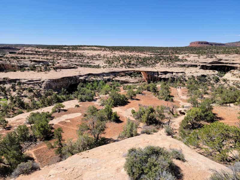
 Kachina Bridge, Natural Bridges National Monument, Utah
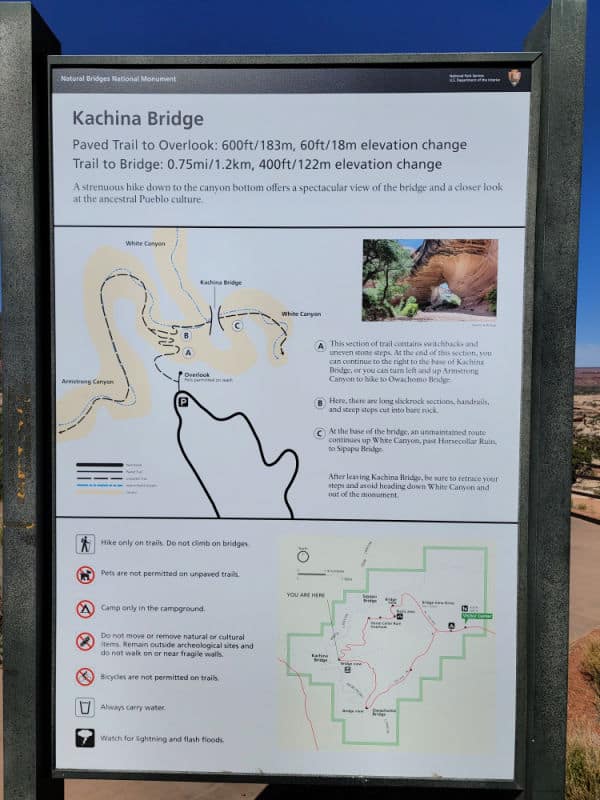
Kachina Bridge
Length Roundtrip: 0.26 miles (0.42 kilometers)
Elevation Change One-way (from Parking Lot to Viewpoint): 45 feet (14 meters) loss, 6 feet (2 meters) gain
- Height: 210 feet (64 meters)
- Span: 204 feet (62 meters)
- Width: 44 feet (13 meters)
- Thickness: 93 feet (28 meters)
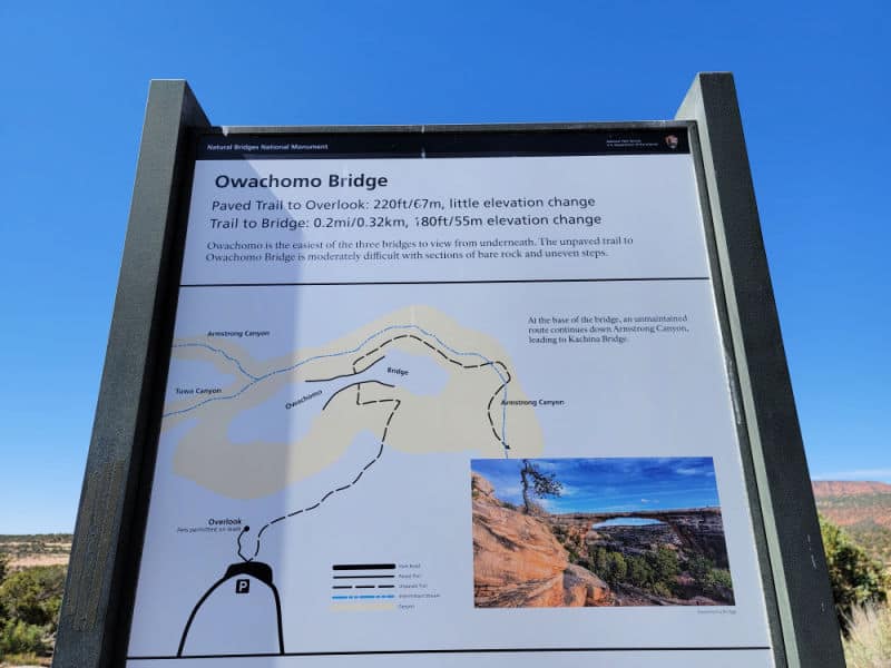
Owachomo Bridge
- Height: 106 feet (32 meters)
- Span: 180 feet (55 meters)
- Width: 27 feet (8 meters)
- Thickness: 9 feet (3 meters)
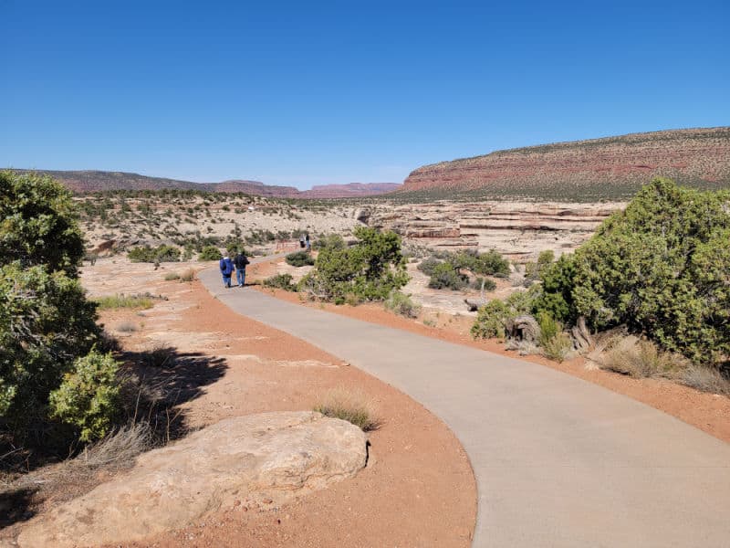
There is a really easy paved path to the Owachomo Bridge overlook. The paved trail is 220 feet and has very little elevation change. This was probably the easiest walkway of the park.
Wildlife/Bird Watching
Most of the wildlife in the park in nocturnal and active at night. There are a few that are crepuscular so you may see them at dawn or dusk.
Diurnal wildlife is active during the day. They have adapted to the temperature range found in the park.
Nocturnal wildlife in the park includes kangaroo rates, skunks, foxes, bobcats, mountain lions and bats.
Crepuscular wildlife in the park includes coyotes, mule deer, porcupines, desert cottontails, black tailed jackrabbits, and songbirds.
Diurnal wildlife that can be seen during the day include rock squirrels, antelope squirrels, chipmunk, lizards, snakes, and hawks.
Hiking in Natural Bridges National Monument
Always carry the 10 essentials for outdoor survival when exploring.
We included the overlooks to each Natural Bridge above in the things to do section. There are also a few longer hikes within the park.
Sipapu Bridge Hike
- Distance - 1.5 miles
- Elevation Change - 500 feet
The Sipapu Bridge Trail is the steepest trail in the park. There is a staircase and three wooden ladders that help with the descent.
Please be really careful around the cliff edges.
Kachina Bridge Hike
- Distance - 1.5 miles
- Elevation Change - 400 feet
The trail follows switchbacks down into the canyon. Please be careful of slick rock, boulders, and any trail hazards.
Owachomo Bridge Hike
- Distance - .5 miles
- Elevation Change - 180 feet
Thid short hike is the shortest one to one of the three natural bridges in the park.
Full Loop Trail
- Distance - 12 miles
- Difficulty - Strenuous
The Full Loop Trail passes all three Natural Bridges as it wanders through the canyons and over the mesa tops.
The loop trail can be accessed from any of the three natural bridges parking lots. Make sure to follow the trail up the left side of the canyon after passing Kachina Bridge in order to pass the "knickpoint" pour off.
The "Knickpoint" pour off into Armstrong Canyon sends a muddy red waterfall after it rains.
Pets are not allowed on the trail. Make sure to check with the visitor center to get the current conditions of the trail.
Sipapu - Kachina Loop
- Distance - 5.7 miles
- Difficulty - Strenuous
- Elevation Change - 500 feet
The Sipapu Kachina Loop passes by both the Sipapu Bridge adn Kachina Bridge while wandering through canyons and over the mesa top.
Pets are not allowed on the trail. Make sure to check with the visitor center to get the current conditions of the trail.
Kachina - Owachomo Loop
- Distance - 6.5 miles
- Difficulty - Strenuous
- Elevation Change - 400 feet
The Kachina Owachomo Loop passes by both the Kachina Bridge and Owachomo Bridge while going through canyons and over the mesa top.
Pets are not allowed on the trail. Make sure to check with the visitor center to get the current conditions of the trail.
Horse Collar Ruin
- Distance - .3 miles
Horse Collar Ruin is one of the best-preserved ancestral Puebloan cliff dwellings in the area.
Start at the Horse Collar Ruin parking area and follow the overlook's unpaved trail 0.3 miles (0.5 kilometers).
Hikers traveling from Sipapu Bridge to Kachina Bridge will pass Horse Collar Ruin.
How to beat the crowds in Natural Bridges National Monument?
We did not experience any major crowds in the park. It is easy to drive to the next overlook or wait for crowds if there are any to dissipate.
Where to stay when visiting Natural Bridges National Monument
There are no National Park Lodges within the National Monument.
The closest lodging is in Blanding, Utah
Stone Lizard Lodging - located in Blanding. Stone Lizard Lodging provides amenities like free continental breakfast and a garden. All guestrooms at Stone Lizard Lodging include premium bedding and air conditioning, as well as amenities like free Wi-Fi and sound-insulated walls.
Inn at the Canyons - located in Monticello. At Inn at the Canyons, you can look forward to free continental breakfast, a grocery/convenience store, and a business center. For some rest and relaxation, visit the hot tub. All guestrooms at Inn at the Canyons include comforts such as air conditioning, in addition to amenities like free Wi-Fi.
Click on the map below to see current hotel and vacation rental rates near the park.
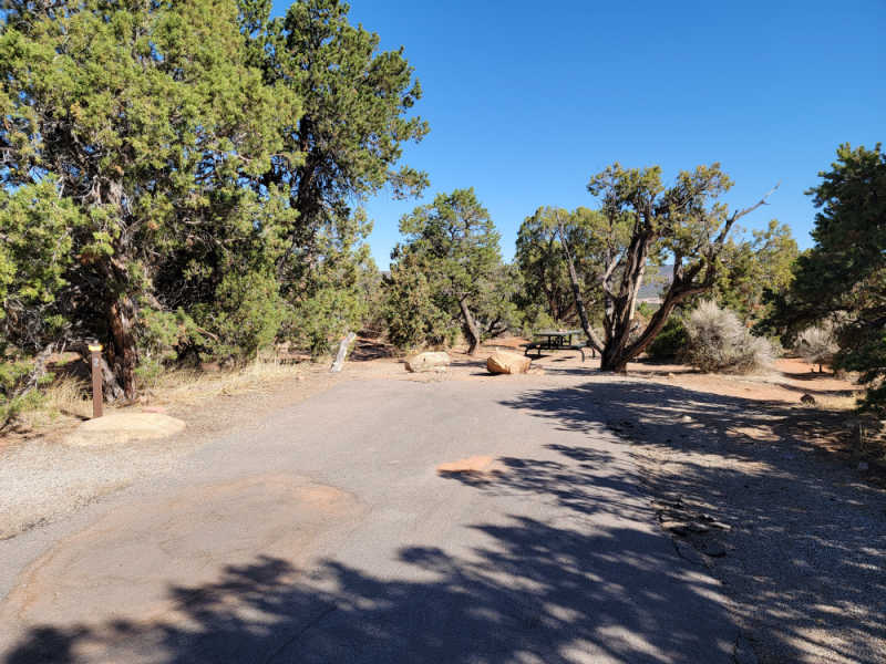
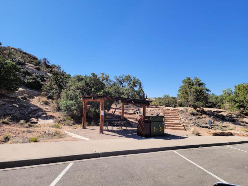
Natural Bridges Camping
The campground is located near the visitor center with 13 sites that are first come first serve.
Check out our article on the Natural Bridges campground for photos and videos.
Parks Near Natural Bridges National Monument
Currecanti National Recreation Area
Rainbow Bridge National Monument
Navajo National Monument
Glen Canyon National Recreation Area
Check out all of the National Parks in Utah along with neighboring Colorado National Parks, Idaho National Parks, Wyoming National Parks, Nevada National Parks, Arizona National Parks, and New Mexico National Parks.
Check out all of the US National Monuments
Make sure to follow Park Ranger John on Facebook, Instagram, Pinterest, and TikTok

Leave a Reply