
Zion is one of America's most beloved National Parks!
The name Zion alone instantly brings thoughts of several iconic popular hikes within the National Park System and is a big reason for the park's tremendous popularity.
Here is a list of the best hikes in Zion National Park
TL;DR Don't have time to read the full article? Here are my top finds:
🏨Hotels and Vacation Rentals
📍Tours
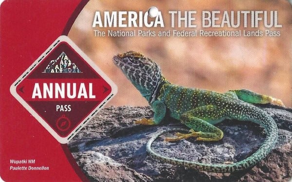
🐻 Save time! Buy your National Park Pass before your trip
Best Hikes in Zion National Park
I have personally hiked almost every trail in Zion and love each one, each for its own reason.
There is a trail for everyone from easy hikes to strenuous hikes, trails to go for a bike ride, horseback ride, and even take your pet for a walk.
Even better is that most of the hikes require you to take a park-operated bus along the Zion Canyon Scenic Drive.
I can't think of a better way to spend a day outdoors than going out and exploring the best hikes in Zion!
Trail Updates
Angels Landing - Permit is now required. Please see the updates below on how to reserve an Angels Landing ticket.
Hidden Canyon Trail - Long-term trail closure due to rockfall.
Observation Point Trail - Access is available via the East Mesa Trailhead (Weather dependent)
Toxic Cyanobacteria Bloom - The park has sent out a warning about a toxic bloom in the Virgin River. Do not submerge your head or filter drinking water from any streams until further notice.
Can I bring my pet on a trail in Zion?
The only trail that pets are allowed on is the Pa Rus Trail.
Pets are not allowed on any other trails, wilderness areas, on shuttle buses, or in Public Buildings in Zion.
Pet owners are required to pick up all pet waste and dispose of it properly, making sure their pet is on a leash no longer than six feet in length, pets are not left unattended, and not harassing wildlife.
Pets are allowed along public roads and parking areas, in the developed campgrounds and picnic areas, and on the grounds of the Zion Lodge.
Service animals may accompany their owner to all park locations.
Keep dogs out of the water. Dogs are vulnerable to cyanotoxin exposure as it is difficult to control how they interact with potentially toxic algal mats. Check our website for current information about the Toxic Cyanobacteria Bloom.
Under the Americans with Disabilities Act (ADA), service animals are defined as dogs that are individually trained to do work or perform tasks for people with disabilities.
Dogs whose sole function is to provide comfort or emotional support do not qualify as service animals under the ADA.
Easy Trails in Zion Canyon
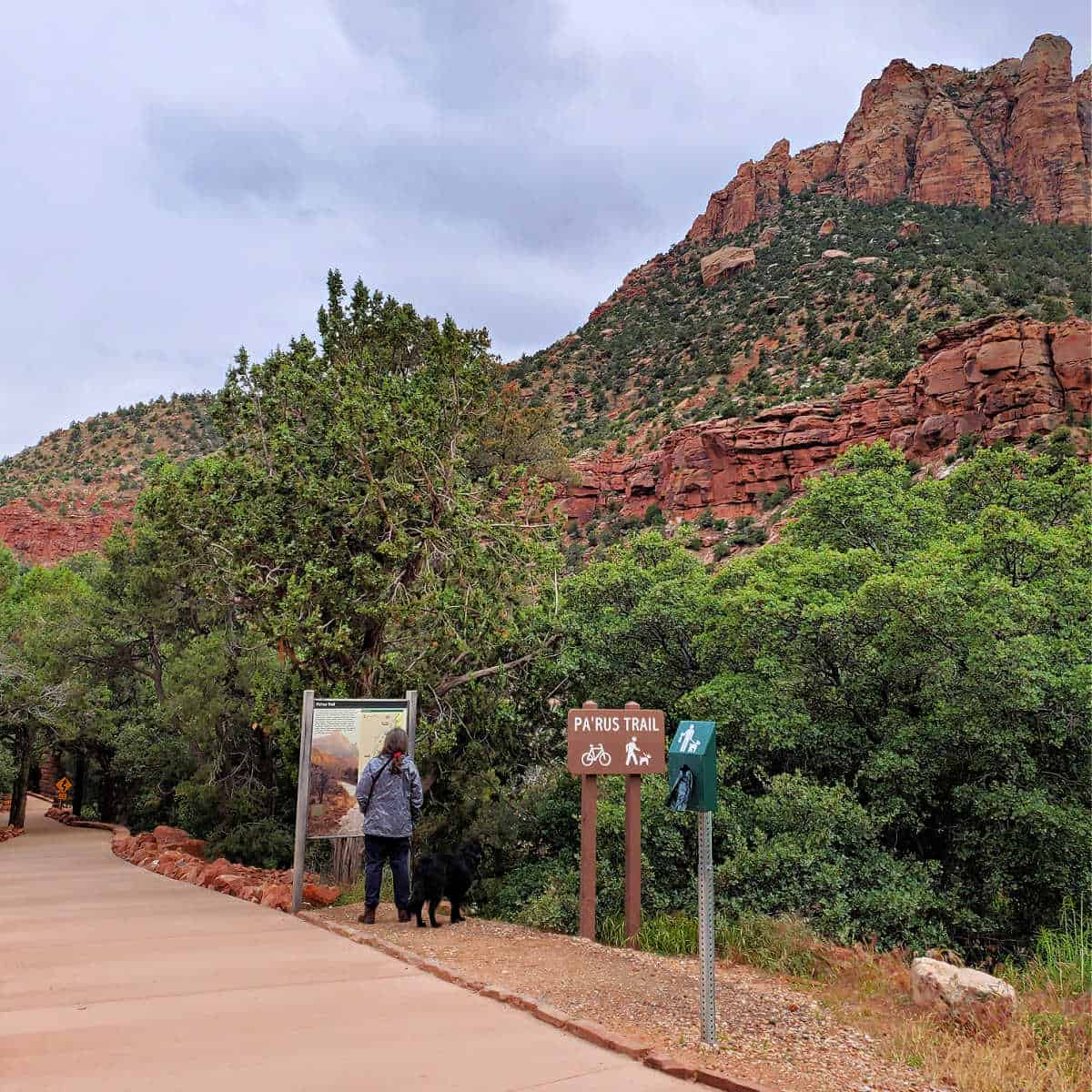
Pa'rus Trail
Trail Length: 3.5 miles
Elevation gain/loss: 50 feet
Hiking Time: 2 hrs.
Trail Difficulty: Easy
Parking: Zion Canyon Visitor Center
ADA Accessible Trail (Wheelchairs may need assistance), Bikes allowed, Pets on leash allowed
The pa'rus Trail is a nice easy stroll along the Virgin River that goes between the visitor center and Canyon Junction stop on the park's shuttle bus.
I found this to be a relaxing stroll with very few people as everyone tends to be on the most popular trails in the canyon. It also goes right by the South Campground and makes for a nice after-dinner walk.
Emerald Pools Zion
Trail Length: 3 miles Roundtrip
Elevation gain/loss: 200 feet
Hiking Time: 2 hours
Trail Difficulty: Moderate
Shuttle Bus Stop: The Grotto
Caution: Minor Drop-Offs, No swimming is allowed in the Emerald Pools
The Emerald Pools is divided into three parts; Lower Pool, Middle Pool, and Upper Emerald Pools. I see books breaking this down into separate hikes but in reality, you can do this easily in one hike.
With the bridge closed at the Zion Lodge bus stop (Stop #5) you will need to take The Grotto bus stop (stop #6) and cross the river and kike the Kayenta Trail to the Emerald Pools Trail.
When you get to the end of the Kayenta Trail, you will have to choose between going left or straight. Left will be a very short walk to the lower pool area and waterfall. Turn back around and go up the trail. This is the Upper Emerald Pool Trail. You will have another half mile up to the upper pool before heading back down.
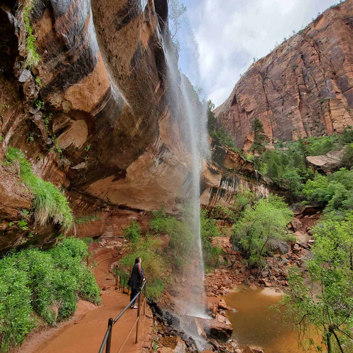
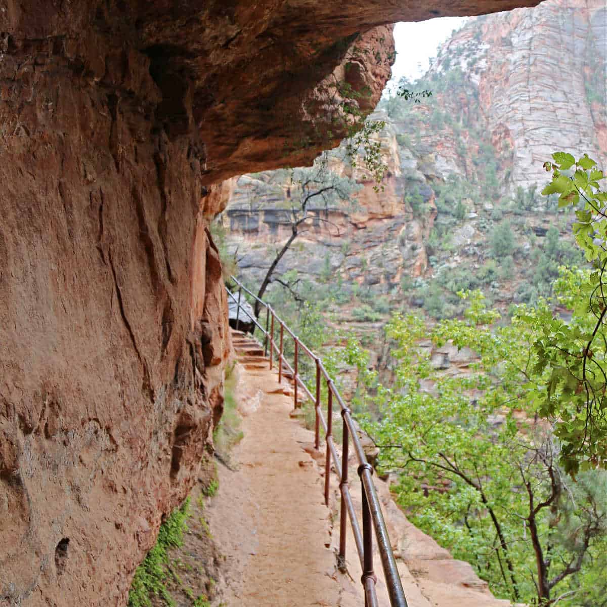
Weeping Rock Trail
Trail Length: 0.5 mile roundtrip
Elevation gain/loss: 100 ft
Hiking Time: .5 hr.
Trail Difficulty: Easy
Shuttle Bus Stop: Weeping Rock Trailhead
This is a short hike but it is a steep walk up a paved trail to a rock alcove with dripping springs. There is several interpretative panels in the area.
Grotto Trail Zion
Trail Length: 1.0 mile
Elevation gain/loss: 35 feet
Hiking Time: .5 hr.
Trail Difficulty: Easy
Shuttle Bus Stop: Zion Lodge and The Grotto
The Grotto serves as a connector trail between the Zion Canyon Lodge and The Grotto bus stop (where people get off for Angels Landing).
I often find myself alone on this trail as most people just take the bus to wherever they are going. This works for me as I enjoy seeing the deer and turkey along this path.
Riverside Walk Zion
Trail Length: 2.2 miles
Elevation gain/loss: 57 feet
Hiking Time: 1.5 hrs.
Trail Difficulty: Easy
Shuttle Bus Stop: Temple of Sinawava
ADA Accessible Trail
The Riverside Walk is an easy hike on a one-mile paved path (two miles round trip). It has stunning scenery with the Virgin River flowing to the side of you making it feel very peaceful.
I have seen deer every time that I hiked this trail and have even seen a tarantula!
The end of the paved trail also marks the beginning of my favorite all-time Zion National Park hikes the Zion Narrows!
Moderate Trails in Zion Canyon
Sand Bench Trail
Trail Length: 7.6 miles
Elevation gain/loss: 466 feet
Hiking Time: 5.0 hrs.
Trail Difficulty: Moderate
Shuttle Bus Stop: Zion Lodge
The Sand Bench Trail is well-named!
You will find yourself hiking in the sand, sometimes soft deep sand. You will also have to take your boots off afterward to return half the sand from the trail back.
This makes for a long day of hiking, especially when it's hot outside.
Also, note this is the path that the horses take. What made this hike great was the fact that I had the place to myself and did not see anyone else all day!
Did I mention that you get a great close-up view of the Court of the Patriarchs? I rewarded my hard work with a shower, a couple of cold beers and a pizza after this hike.
Park Ranger John Pro Tip: Instead of hiking the Sand Bench Trail, you can take a three-hour guided horseback ride. this is a great way to see the Canyon and saving yourself from a difficult, hot sandy hike.
Watchman Trail
Trail Length: 2.7 miles roundtrip
Elevation gain/loss: 368 feet
Hiking Time: 2.0 hrs.
Trail Difficulty: Moderate
Shuttle Bus Stop: Zion Visitor Center next to the bridge crossing the Virgin River
The trail starts by the park visitor center and gradually climbs up and most of the trail is open with no shade. The trail eventually climbs to a point where there is sweeping views of the Lower Zion Canyon in both directions, Oak Creek Canyon, and Springdale
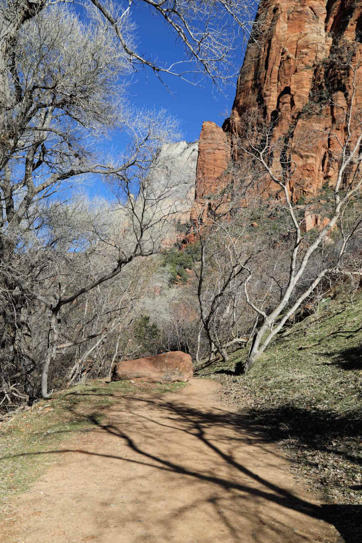
Kayenta Trail
Trail Length: 2.0 miles Roundtrip
Elevation gain/loss: 150 feet
Hiking Time: 1 hour
Trail Difficulty: Moderate
Shuttle Bus Stop: Zion Lodge
The Kayenta Trail is located across the river from the Grotto Bus Stop. It provides very nice views of the Virgin River before connecting to the Emerald Pools Trail
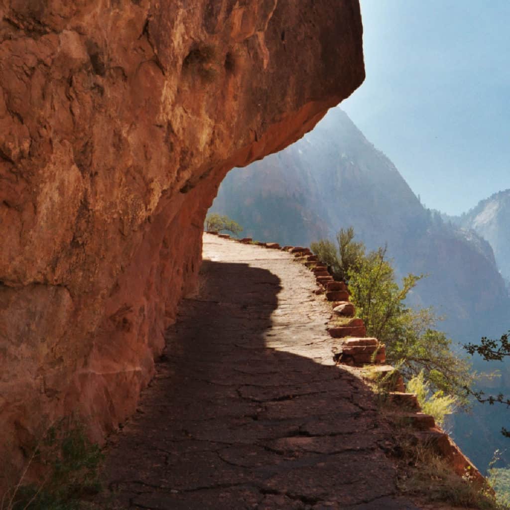
Canyon Overlook Trail
Trail Length: 1 mile
Elevation gain/loss: 163 feet
Hiking Time: 1 hr.
Trail Difficulty: Moderate
Parking: East Side of the tunnel, Zion-Mt. Carmel Hwy
Caution: Long Drop-Offs
Canyon Overlook Trail is located just outside the East entrance of the Zion-Mt. Carmel Tunnel.
Parking is limited on both sides of the road and it can be extremely difficult to find a spot. It can also be a real pain to get in and out of the parking lot because quite often there is a long line to go through the tunnel.
Having said that, this hike is fun! You start off with a series of steps and then a small bridge attached to the side of the cliff wall.
It continues under the wall and out to a nice view at the end. It's one of my favorite short hikes!
Strenuous Trails in Zion Canyon
Zion Narrows
Trail Length: 9.4 miles
Elevation gain/loss: 334 feet
Hiking Time: 8.0 hrs.
Trail Difficulty: Strenuous
Shuttle Bus Stop: Temple of Sinawava
Caution: Check the visitor center for Flash Flood Conditions before starting this hike.
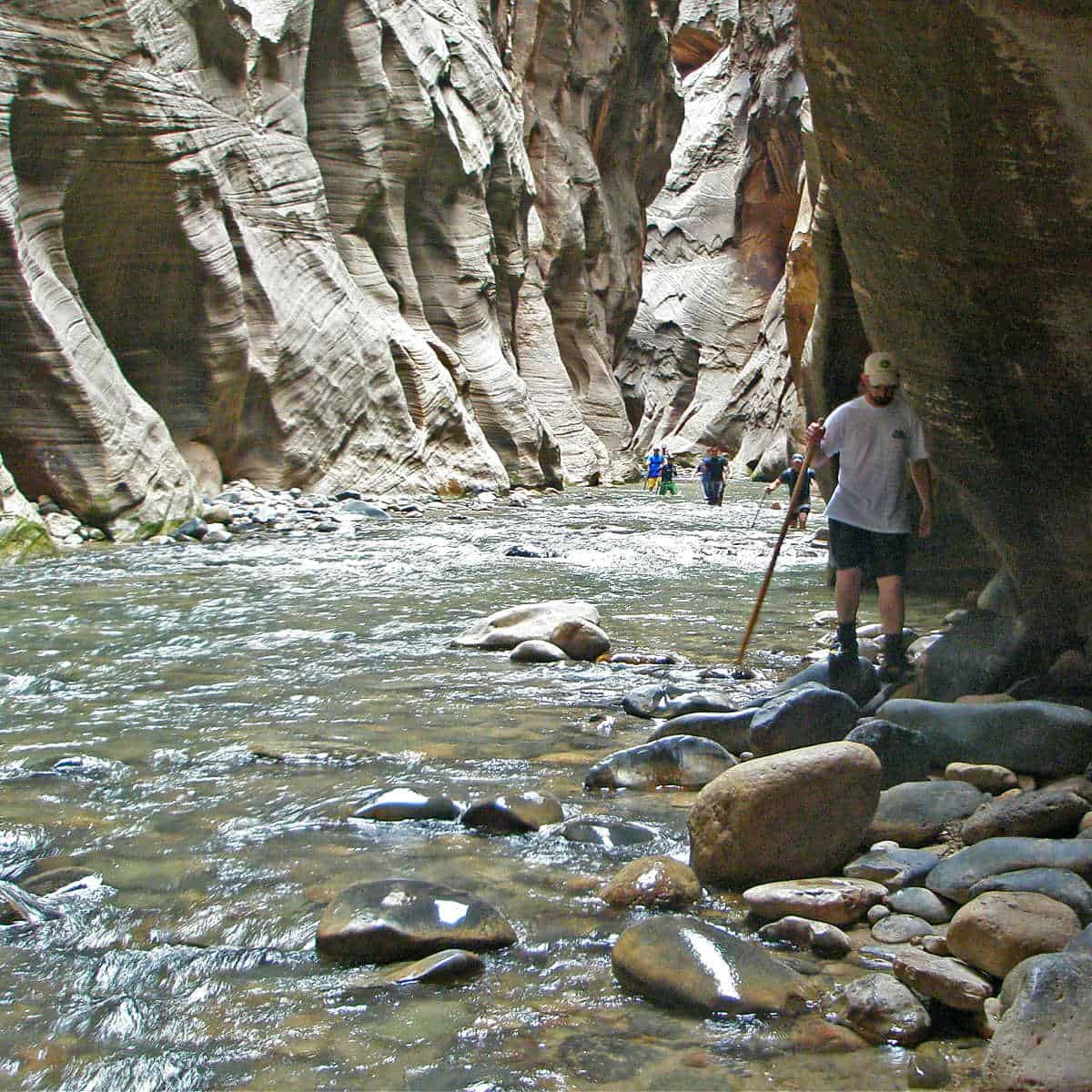
The Zion Narrows Hike is a must-do for anyone visiting this park! This classic hike can be done in one of two ways.
Most people take the park's shuttle bus to the Temple of Sinawava shuttle bus stop. From here they hike the one mile Riverside Walk and then enter the Virgin River.
From here most people usually hike upstream for two to three miles to the famous Wall Street and Orderville Canyon area before turning around and heading back.
Wall Street is where the canyon is very narrow and the walls of the slot canyon are very tall. The sun never really sees this section and you are pretty much just walking in the river at this point.
The second option is to hire a Zion Narrows Shuttle to Chamberlain Ranch and hike down 16 miles of the North Fork of the Virgin River. This requires a wilderness permit issued by Zion National Park and most people take two days and camp overnight within the canyon.
Hiking the Narrows does require some preparation. You will need sturdy shoes and trekking poles. There are outfitters just outside the park who rent water shoes and hiking sticks.
You will also need to check with the park visitor center and check the flash flood danger before heading out.
This hike is typically done during the summer and fall.

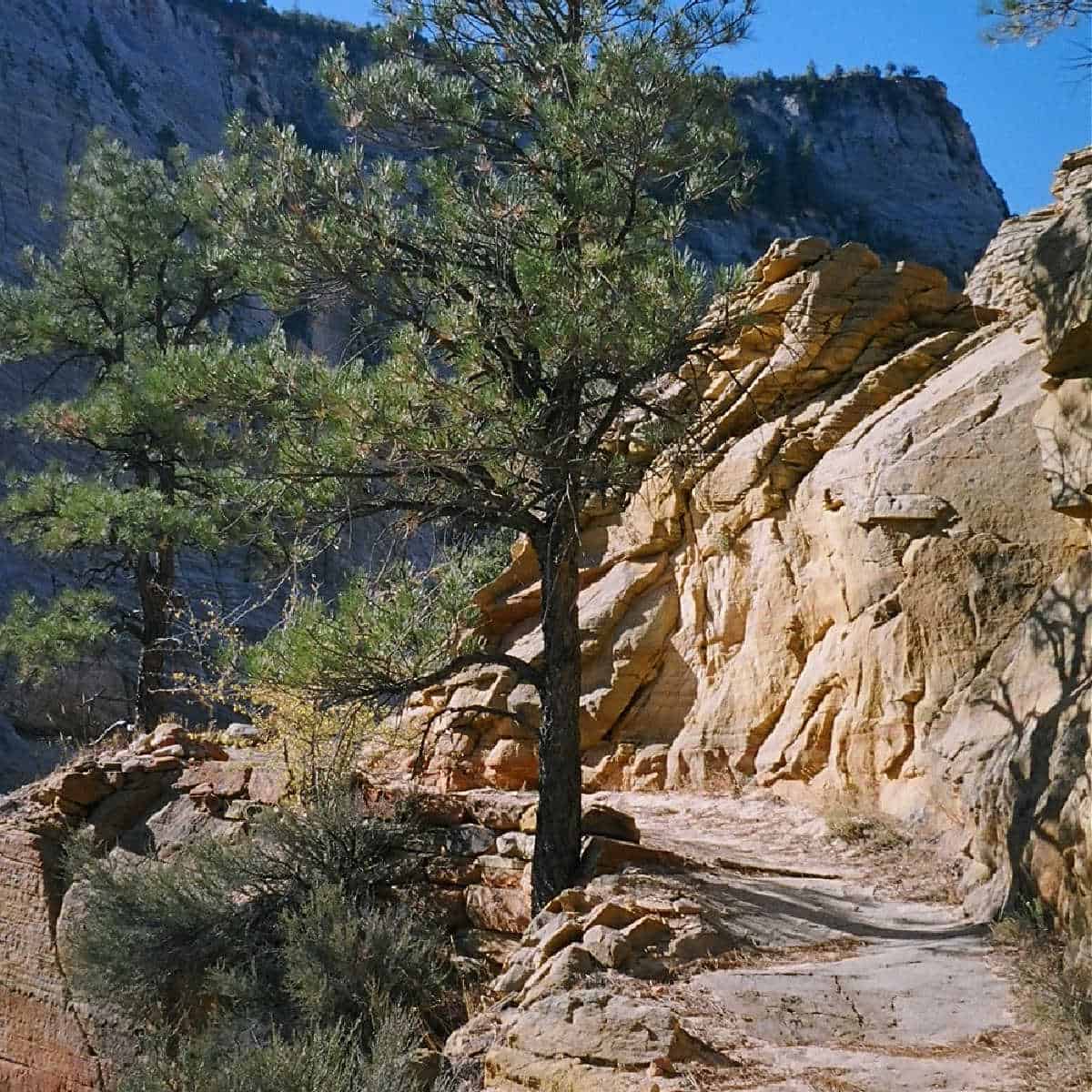
Angels Landing Zion
Trail Length: 5.4 miles
Elevation gain/loss: 1488 feet
Hiking Time: 4+hrs.
Trail Difficulty: Strenuous
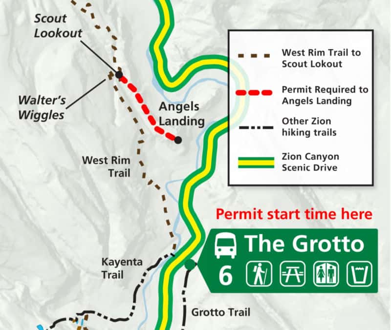
Shuttle Bus Stop: The Grotto
Caution: Long Drop-Offs
Angels Landing Tickets
Angels Landing is by far one of the most popular hikes in the National Parks system! This created problems with crowding, congestion, and safety issues on this narrow trail with steep drop-offs. The National Park Service had to implement a permit system with a limited number of permits per day, requiring hikers to obtain a permit to hike this trail.
There are a couple of ways to obtain an Angels Landing Permit.
- Seasonal Lottery
With the seasonal lottery you can pick seven ranked days and times or windows of days and times you want to hike.
There are specific dates you need to apply for a permit based on when you want to complete the Angels Landing Hike!
It costs $6 to apply for a seasonal permit. The fee covers an application for up to 6 people (including the person filling out the application). This fee is non-refundable.
The permit system is handled through Recreation.gov.
If you are chosen for a permit you will receive an email from Recreation.gov informing you that you have a permit and you will be charged $3 for each person you registered.
Make sure to print or download a copy of the confirmation email and bring it with you on your hike. Mobile phone service is unreliable at the permit checkpoint so be sure to print or download before you arrive.
2. Day Before Lottery
You can apply for an Angels Landing Permit the day before you plan to hike. This lottery opens every day at 12:01 a.m. and closes at 3 p.m. Mountain Time (MT).
It costs $6 to apply for a permit which covers up to 6 people being on the application. This fee is non-refundable.
Permits are issued at 4pm mountain time the day you apply so make sure you have your application in by 3pm.
At 4pm you will receive an email that confirms if you have a permit for the next day. If you receive a permit you will be charged $3 per person listed on the application.
Please make sure to print or download your confirmation email!!!
Once you receive a permit make sure you check the Zion shuttle schedule and have plans in place to make it in time for your permit time.
The time printed on your permit is the time you need to be at Shuttle Stop 6, the Grotto.
3. Book a guided hike that includes a permit
⭐️ Rating: 5 out of 5 Stars | ⏳ Tour Length: 4-6 hours | 🥾Check Rates and Availability
Don't miss the opportunity to hike Angels Landing because you don't have a permit! I found a Private tour for you and your group only, and your guide can help you navigate logistics, manage safety, and provide insight into the natural and cultural history of the park.
Zion National Park Angels Landing Hike is one of the most memorable hikes you can experience in Zion, both mentally and physically.
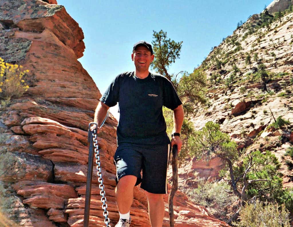
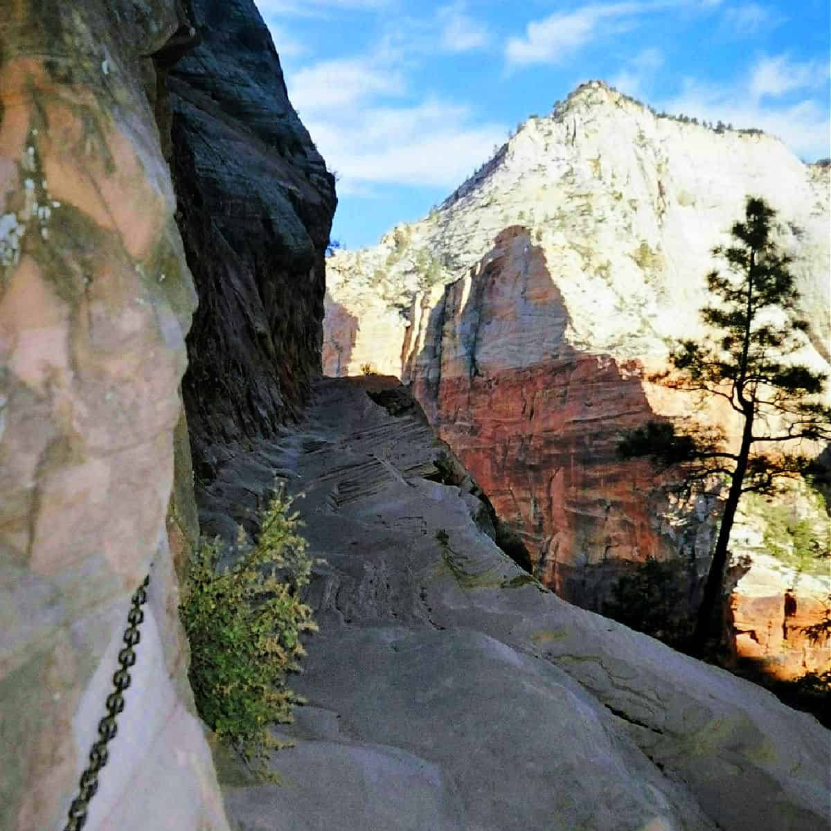
It all starts as a leisurely hike as you cross a bridge and make your way up towards Refrigerator Canyon. The trail quickly changes from a leisurely stroll to a steep climb when you reach Walter's Wiggles (a series of 21 steep switchbacks) before you arrive at Scout Lookout.
This is where you feel like you are on a stair climber for what seems like forever.
Walter's Wiggles is a series of switchbacks that steeply climbs up to Scout's Lookout. This makes for a great resting spot before heading up to Angels Landing.
It gets much more exciting from here out as you find yourself holding onto chains and hiking along sheer drop-offs as you look down canyon walls to the valley below!
Did I mention this hike is not for anyone with a fear of heights?
I mean seriously you will be walking in areas that are only several feet wide and cliff drop-offs hundreds of feet down with only a chain to hold on to. I'm sure you will find my fingerprints in a few of the chains from me grabbing them so hard.
The view at the end is truly something magical and makes the trek to the top of angel's landing worth every step as you look out into the heart of Zion!
Subway Zion
Trail Length from Bottom-up: 9 miles
Elevation gain/loss: 400 Feet.
Hiking Time: 7-9 Hrs.
Trail Difficulty: Strenuous
Trailhead: Left Fork Trailhead on the Kolob Terrace Road.
Caution: This hike requires route finding, creek crossing, and scrambling over boulders
Permit Required
The Subway is one of the Iconic National Park Hikes! Its popularity has risen rapidly over the years as photos like the one pictured above started showing up on calendars, postcards, and all over every social media channel.
It has become so popular that the National Park Service had to begin limiting the number of people to protect resources and the crazy parking problems. you have to obtain a permit before entering.
This trail also brings the adventure factor as you can do canyoneering going from the top-down, doing some route finding, crossing water, and scrambling over rocks and boulders.
Subway Zion Permit
Due to the popularity of the Subway, the National Park Service has created an online lottery for reservations.
You can fill out an online Advance Lottery application which must be submitted three months prior to your planned trip and is limited to one request per individual per month.
You can request three prioritized dates and there is a non-refundable lottery application fee of $5.00.
Click Here for more information on the National Parks Services website about hiking the Subway.
Park Ranger John Pro Tip: Don't want to mess with getting a permit to explore the Subway Zion? Go between November-March as a permit is not required during these times as there is a low demand for permits.
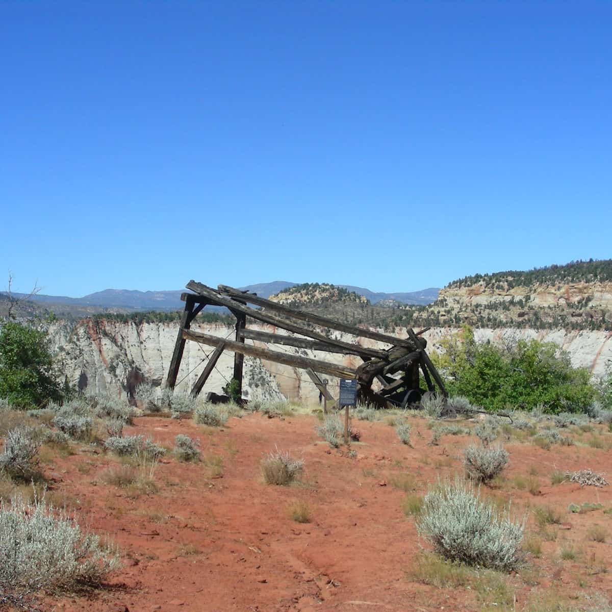
Cable Mountain Trail Zion
Elevation gain/loss: 1075 feet
Hiking Time: 3.5-4.5 hours
Trail Difficulty: Strenuous
Trailhead: Stave Spring Trailhead
Update: East Rim Trail from Weeping Rock through Echo Canyon is Closed Indefinitely
Since the closure of Echo Canyon, the easiest way to access the Cable Mountain Trail is to have a high clearance 4X4 vehicle and drive out to the Stave Spring Trailhead at the border of the park behind Zion Ponderosa Resort.
You can also access the Deertrap Mountain trail from the Cable Mountain Trail.
I hiked both trails at once and made it a two-for-one! I loved the solitude here as I only saw one other couple the entire hike!
The highlight of the Cable Mountain trail is a fantastic view down into the canyon plus you get to see the remains of an old wood-frame "draw works" that was used to lower timber to the canyon floor.
My words of advice are to always come prepared! Read my 10 Essentials post for a great example from this hike!
Observation Point Zion
With the major rockslide that blocked Echo Canyon, you can now only access Observation Point from the East Mesa Trailhead or from hiking the East Rim Trailhead from Highway 9.
From East Mesa Trailhead
Trail Length: 7.0 miles
Elevation gain/loss: 700 feet
Hiking Time: 3-4 hours
Trail Difficulty: Moderate
Shuttle Bus Stop: N/A, Park at the East Mesa Trailhead
Caution: Long Drop-Offs
Update: East Rim Trail from Weeping Rock through Echo Canyon is Closed Indefinitely
From the East Mesa Trailhead: First be cautioned that this trailhead is in the high country in Zion and oftentimes gets snow in the winter as the trailhead sits at approximately 6,600 feet in elevation!
The road also gets muddy and slick when wet and snow-covered in the winter. If you drive to this trailhead, a high clearance 4X4 vehicle is a must. There is a shuttle service in the summer offered by East Zion Adventures.
After making it to the trailhead, the hike seems like a breeze! It is relatively flat except for the last half mile and the view from Observation Point is my favorite in all of Zion!
From here, you look out and see the tiny sliver of road and Angels Landing well below you and down the canyon.
I sat back took my boots and socks off and had lunch with an amazing view!
If you hike from the East Rim Trailhead off of Highway 9, you will be attempting a 20+ mile hike so I would recommend going Spring through fall from the East Mesa Trailhead until Echo Canyon is cleared.
Hidden Canyon Zion
Trail Length: 2.4 miles
Elevation gain/loss: 850 feet
Hiking Time: 2.5hrs.
Trail Difficulty: Strenuous
Shuttle Bus Stop: Weeping Rock
Caution: Long Drop-Offs
Update: The trail is Closed due to a large rockslide. East Rim Trail from Weeping Rock through Echo Canyon is Closed Indefinitely.
Hidden Canyon can be either its own hike or in combination with the Observation Point Zion hike.
I chose to do both hikes at once and it turned out to be a great idea, especially as most of the elevation change was from the parking lot to the trail cutoff between Hidden Canyon and Observation Point.
Hidden Canyon is absolutely beautiful and the hike getting to the canyon will give you a little taste of what it's like to hike Angels Landing with its long drop-offs and chains to hold on to.
The bonus here is that you have a wall with chains on one side instead of having sheer cliffs on both sides making it feel not as extreme but it will still provide you with some heart-pounding excitement.
The trail technically ends at the mouth of Hidden Canyon but there is a beautiful Hidden Canyon Arch a short distance away and where I saw most people turning around.
From here make your way back to the main trail and continue up towards Observation Point.
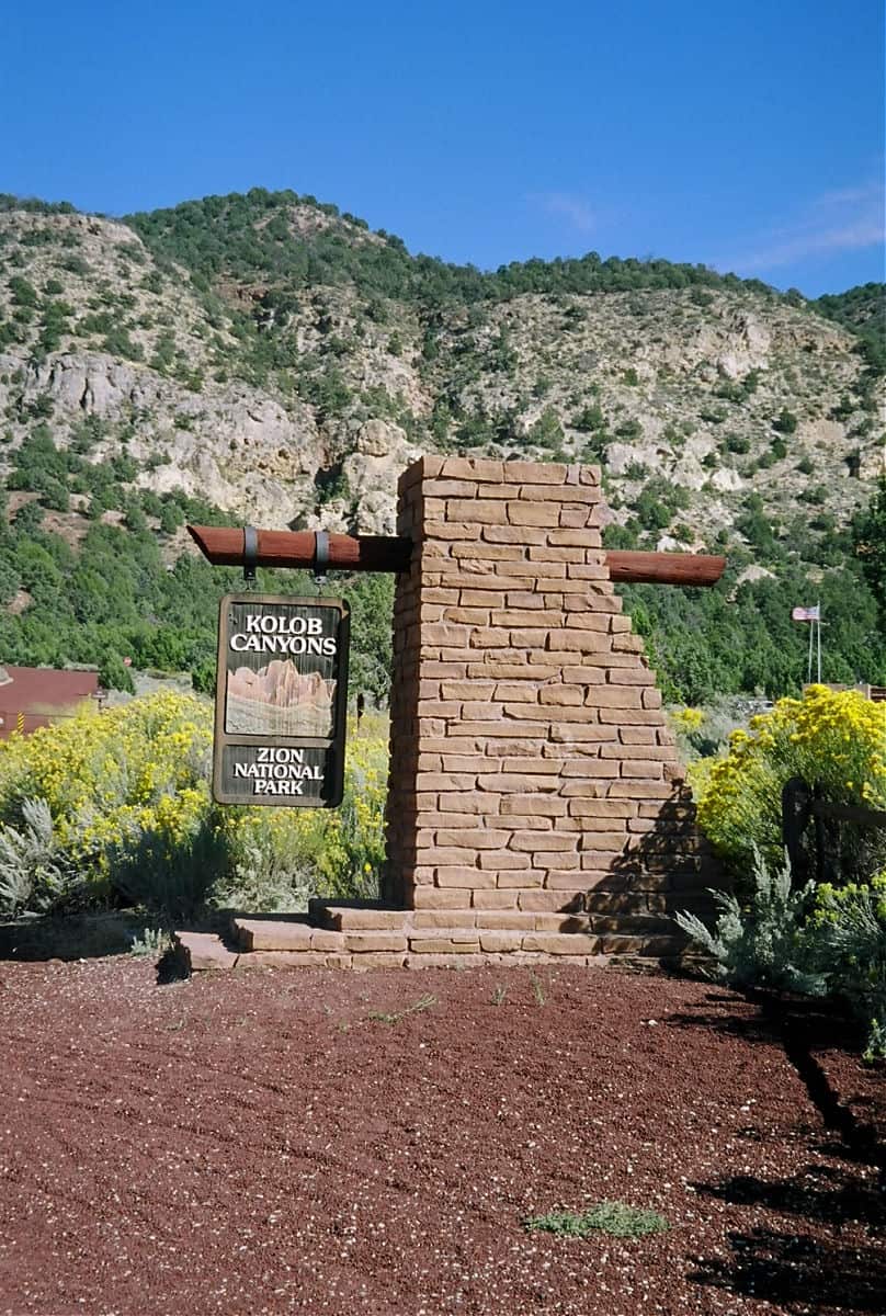
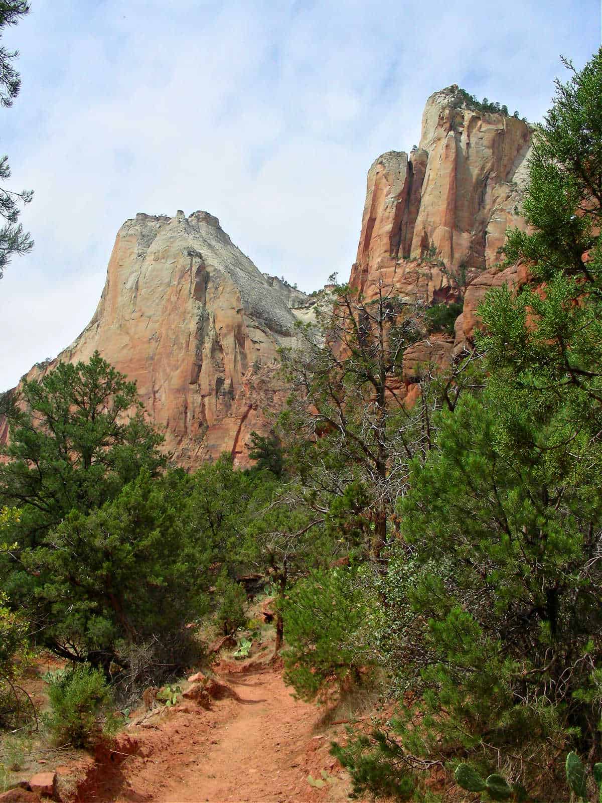
Kolob Canyons Trails
The Kolob Canyons is located in the Northwest corner of the park.
Here you will find narrow parallel box canyons that are cut into the western edge of the Colorado Plateau with majestic peaks and 2,000-foot cliff walls.
Timber Creek Overlook Zion
Trail Length: 1.0 miles roundtrip
Elevation gain/loss: 100 feet
Hiking Time: 30 minutes
Trail Difficulty: Moderate
Parking Lot: Kolob Canyons picnic area
The Timber Creek overlook trail follows the ridge top up to a small peak with views of Timber Creek, Kolob Terrace, and Pine Valley Mountains
Taylor Creek Trail Zion
Trail Length: 5.0 miles roundtrip
Elevation gain/loss: 450 feet
Hiking Time: 4 hours
Trail Difficulty: Moderate
Parking Lot: 2 miles East of the Kolob Canyons Visitor Center
Taylor Creek Trail follows the middle fork of Taylor Creek as it passes two homestead cabins on its way to Double Arch Alcove.
This is a good option in the hot summer months as Kolob Canyons tend to be less crowded than the main canyon of Zion. It also has shaded areas, especially as you go further up the canyon.
Kolob Arch Zion
Trail Length: 14.0 miles roundtrip
Elevation gain/loss: 700 feet
Hiking Time: 8+ Hours
Trail Difficulty: Strenuous
Parking Lot: Lee Pass
Take the la verkin creek trail to the Kolob Arch trail. The first part of this trail is fairly steep as you drop down into the canyon along Timber Creek.
The trail passes through Cottonwood Trees and leads to the Kolob Arch connector trail.
The trail is a bit tricky to navigate and requires some scrambling but the payoff is worth it as you get to see what is possibly the world's largest free-standing arch!
Zion National Park Lodging Options
Lodging Options inside Zion National Park
⭐️ 4.5 of 5 Stars - Zion Lodge - Click here for Rates and Availability.
Spend the night in the heart of the Zion Canyon giving you the easiest access to some of Zion's most popular trails! You are next to the restaurant, and several trails inthe park. You also have a nice room with numerous amenities, and the views of the canyon are the cherry on top! Definately worth booking.
⭐️ 4.5 of 5 Stars - Zion Cabins - Click here for Rates and Availability.
The cabins are located next to the Zion Lodge in the heart of the Zion Canyon and perfect for exploring Zion Canyon! You are steps away from the Emerald Pools Trail and a short Distance to Angels Landing. As far as the cabins, they are very comfortable with a gas fireplace and epic views. Don't miss on this opportunity!
Lodging outside of the park
⭐️ 4.7 of 5 Stars - Cliffrose Springdale, Curio Collection by Hilton - Click here for Rates and Availability.
Breathtaking property just minutes 5 minutes (by shuttle)to the Zion National Parks entrance! The historic Cliffrose Lodge sits on the edge of the Virgin River, steps from local dining, a firepit and a garden, have two outdoor heated pools and hot tubs open year-round and private beach. this hotel is the perfect place to soak up some sun and relax in comfort with numerous amenities!
⭐️ 4.8 of 5 Stars - Best Western Plus Zion Canyon Inn & Suites - Click here for Rates and Availability.
Consider a stay at Best Western Plus Zion Canyon Inn & Suites and take advantage of a free breakfast buffet, laundry facilities, and a 24-hour health club. For some rest and relaxation, visit the hot tub. In addition to a 24-hour business center, guests can connect to free in-room Wi-Fi.
⭐️ 4.5 of 5 Stars - Fairfield Inn & Suites by Marriott Virgin Zion National Park - Click here for Rates and Availability.
Experience Southern Utah's largest hotel at the award-winning Fairfield Inn and Suites Virgin Zion National Park, featuring 190+ rooms with stunning Kolob Canyon views and Virgin River access. Unwind in oversized pools, a family water feature area, and a scenic hot tub after exploring nearby Zion National Park. Every room includes king bed options, high-speed WiFi, 55" Smart TVs, and modern amenities, plus private balconies or patios to soak in the breathtaking landscape.
Click on the map below to see additional hotels and vacation rentals near Zion National Park
Best Zion National Park Tours & Adventures
Peek-A-Boo Slot Canyon Tour UTV Adventure (Private)
⭐️ Rating: 5 out of 5 Stars | ⏳ Tour Length: 2 hours | 🚌Check Rates and Availability
Journey into slot canyon in a UTV that can tackle the sandy trails on a, off the beaten path location far from the crowds of Zion's most visited areas. Then take a short hike into the canyon where your guide will tell you all about the geology and history. Afterward, there is someoptional sandboarding fun.
The Narrows: Zion National Park Private Guided Hike
⭐️ Rating: 5 out of 5 Stars | ⏳ Tour Length: 7 hours | 🥾Check Rates and Availability
Explore the incredible Zion Narrows portion of Zion National Park on this private Day-Tour. Your guide will teach you about the geology, formation, and plants and animals that call this canyon home. This tour comes with:
- Lunch that includes a Charcuterie Board with cured meats, cheeses, pickled goods, nuts, crackers and spreads.
- Snacks/Bottled Water
- Trekking Poles/ Canyoning Boots with Neoprene Socks/ Waterfroof Backpack
- Watertight Bib Waders (October-May)
East Zion Canyoneering: Elkheart Canyon & UTV Tour
⭐️ Rating: 5 out of 5 Stars | ⏳ Tour Length: 3-4 hours | 🥾Check Rates and Availability
Have you ever wanted to try the hottest new craze of Canyoneering? I know I have! Here you go with a small group and begin with an off-road drive through the mountains, then go for a hike along the red rocks to reach the canyon. Then the fun really begins as you rappel down the canyon walls and explore this unique rock formation at your leisure. The best part is that you can feel safe doing this with a certified guide leading the way and provides Canyoneering Equipment.
Don't hesitate on this tour, as they typically sell out 50 days in advance!
There are numerous tours offered in Zion National Park, Here are a few more tours of Zion if you did not see what you wanted.
Zion National Park Entrance Fee
New in 2026: Each Non-US Resident aged 16 and older visiting Zion National Park must pay a $100 nonresident fee (in addition to the standard entrance fee), unless admitted with an annual or America the Beautiful Pass. This includes nonresidents entering as part of a commercial tour group, commercial use authorization (CUA) group, or concessioner tour group.
Park entrance fees are separate from camping and lodging fees.
Park Entrance Pass - $35.00 Per private vehicle (valid for 1-7 days from the date of purchase)
Park Entrance Pass - Motorcycle - $30.00 Per motorcycle (valid for 1-7 days from the date of purchase)
Park Entrance Pass - Snowmobile - $20.00 Per Snowmobile (valid for 1-7 days from the date of purchase)
Per-Person Entrance Pass - $20.00 Visitors 16 years or older who enter on foot, bicycle, or as part of an organized group not involved in a commercial tour.
Annual Park Entrance Pass - $70.00, Admits pass holder and all passengers in a non-commercial vehicle. Valid for one year from the month of purchase.
$20.00 for Non-Commercial Group (16+ persons)
$70.00 for Commercial Van with 7-15 seats
$80.00 for Commercial Mini-Bus with 16-25 seats
$190.00 for Commercial Motor Coach with 26+ seats
Learn more about National Park Passes for parks that have an entrance fee.
$80.00 - For the America the Beautiful/National Park Pass. The pass covers entrance fees to all US National Park Sites and over 2,000 Federal Recreation Fee Sites for an entire year and covers everyone in the car for per-vehicle sites and up to 4 adults for per-person sites.
Buy your pass at this link, and REI will donate 10% of pass proceeds to the National Forest Foundation, National Park Foundation, and the U.S. Endowment for Forestry & Communities.
National Park Free Entrance Days -Mark your calendars with the free entrance days the National Park Service offers for US citizens and residents.
Zion National Park Resources
Zion National Park Guide- Your complete guide to exploring Zion National Park
Things To Do Zion National Park- List of things to do at Zion National Park including horseback riding, ranger programs, and exploring the town of Springdale!
Zion Shuttle Guide- Learn when the shuttles are running and how to use them to plan your trip to Zion
Zion Narrows planning guide- The ultimate guide to plan your hiking adventure to the Zion Narrows. Includes both day hikes and top-to-bottom overnight hikes.
Emerald Pools Trail Guide- Plan your trip to one of Zion's most iconic trails!
Zion Camping Resources
Zion National Park Camping Guide- Complete guide to camping in Zion National Park
Watchman Campground- Zion's main campground is located next to the visitor center and the park shuttle stop. The campground has 176 campsites, 95 electric hookups, and 7 group sites.
South Campground- Centrally located next to the visitor center, the shuttle bus stop, the Parus Trail, and the Virgin River. The campground has 117 campsites and no RV hookups.
Additional State and Tribal Parks Near Zion National Park
Valley of Fire State Park (Nevada)- an incredible park with great trails and jaw-dropping scenery between Las Vegas and Zion!
Upper Antelope Canyon- The slot canyon that every photographer on the planet desires to photograph!
Monument Valley- The most iconic scenery of the American Southwest and the location of countless Western movies.
Valley of the Gods- This is a park where you can spend as little as a couple hours and complete the 17-mile scenic drive and truly get an appreciation of the area.
Goosenecks State Park (Utah)- amazing views of the San Juan River twisting and turning causing epic goosenecks in the canyon 1,000 feet below.
Goblin Valley State Park (Utah)- is best known for its goblin-like geologic features that can be easily seen.
National Parks near Zion National Park
Pipe Springs National Monument- learn about the Mormon War!
Lake Mead National Recreation Area- Explore all the recreational opportunities along Lake Mead and around Hoover Dam
Tule Springs Fossil Beds National Monument - If you are flying into Las Vegas on your way to Zion this is an easy park to visit on the way.
Bryce Canyon National Park- No matter if you see Bryce in the summer or snow, at sunrise or the middle of the day, its breathtaking scenery and hoodoos will leave you inspired and awestruck!
Cedar Breaks National Monument- Another gift from nature, the mini Bryce Canyon with sunsets that will dazzle your imagination! They have pretty epic fall colors too
Grand Canyon National Park- nicknamed "The Big Ditch" is something you just have to see to believe! Its wonders are hard to put into words, photographs can only capture a small portion of its epicness! It truly is one of the seven wonders of the natural world!
Capitol Reef National Park- The least visited of the 5 National Parks in Utah is what I call one of the top hidden Gems in the National Park System! It has epic scenic drives, epic hikes, jaw-dropping scenery, and much more!
Arches National Park- A hikers and photographers paradise! Arches is home to over 2000 natural sandstone arches, many of which will blow your mind!
Canyonlands National Park- Canyonlands is broken down into 3 sections, each filled with the charm and rugged beauty of the American Southwest. It's easy to see some of the highlights but its real charm come to those who plan and prepare to go deep into the wilderness.
Check out these other great Utah National Parks, Nevada National Parks, Idaho National Parks, Wyoming National Parks, Colorado National Parks, New Mexico National Parks, and Arizona National Parks.
Make sure to follow Park Ranger John on Facebook, Instagram, Pinterest, and TikTok


Harold Kinder says
Enjoyed your article on Zion. My wife and I visited the park around May 20, and we're, if course struck by its beauty. However, I got the impression, reinforced by your article, that Zion is best suited for hikers rather than more casual visitors like us. Although we are in our early 70s, we are healthy and vigorous, but I am afraid of heights. This ruled out just about everything going but the River Walk.my question: Do you think it is prudent for NPS to advise/warn folks that many of the hikes there are scary for many and require lots of energy? Thanks for a great article. Loved Arches and Bryce!
JohnTillison says
Harold,
Thank you for stopping an and reading my article. There are many things to do at Zion National Park for all physical abilities. It's true that many of the hikes have steep cliffs and elevation gain as you go inside the Zion Canyon. There are several that you can still do. The Riverside walk is a beautiful paved 1-mile hike into the Zion Canyon before getting into the River to hike the Narrows. The scenery is beautiful too! You can hike the Grotto Trail, a 1/2 mile easy hike and I have seen deer every time I have hiked it. The hike to Lower Emerald pools is pretty easy and worth the trip as well, use your best judgment from there how far you want to go up. Also check out my article on things to do Zion for other activities in the park and good luck with planning your trip!
Amy Bellgardt says
I have always wanted to visit Zion! Great post. 🙂
Stephanie says
We are staying on the east side. Any trail recommendations with kids?
JohnTillison says
Trails on the East side of Zion include:
Canyon Overlook Trail- Fun 1 mile in and out trail with little elevation gain. It does have steep drop-offs
East Rim Trail- Is a strenuous 7.2-mile hike with almost 3000 feet of elevation gain. (Probably not the easiest for kids)
Cable Mountain-Cable Mountain is accessed through the East Rime Trail and has a nice view of Zion Canyon but again a long strenuous hike probably not for children.
Deertrap Mountain- Also accessed through the East Rim Trail and a strenuous hike. Remember the East side is also a more remote part of Zion so if you decide to go make sure to carry the 10 essentials. There is also a good story of my experience needing the 10 essentials while hiking Deertrap Mountain Trail.
I highly suggest visiting Zion Canyon. There are eseveral hikes suitable for children including the Riverside Walk, Pa'Rus Trail, Archeology Trail, Lower Emerald Pools Trail, the Grotto Trail and Weeping Rock.
I hope this helps & enjoy Zion!
Jeff says
Hi John,
I am an art teacher in Nashville (who occasionally gets to do some art) who would like to have permission to take one of your pics on this Zion page and render it in acrylics. I’ve done a series of paintings in Utah from my own pics, but I was just really struck by your pic that overlooks Angel’s Landing. Would that be alright? I could email you a jpeg if the finished product. Thanks,
Jeff C.
JohnTillison says
Hi Jeff, That sounds amazing. I would love to see how the painting turns out.